Projects
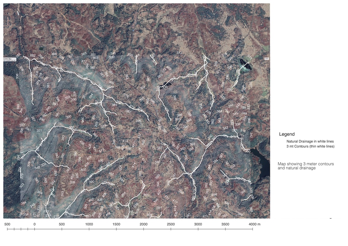
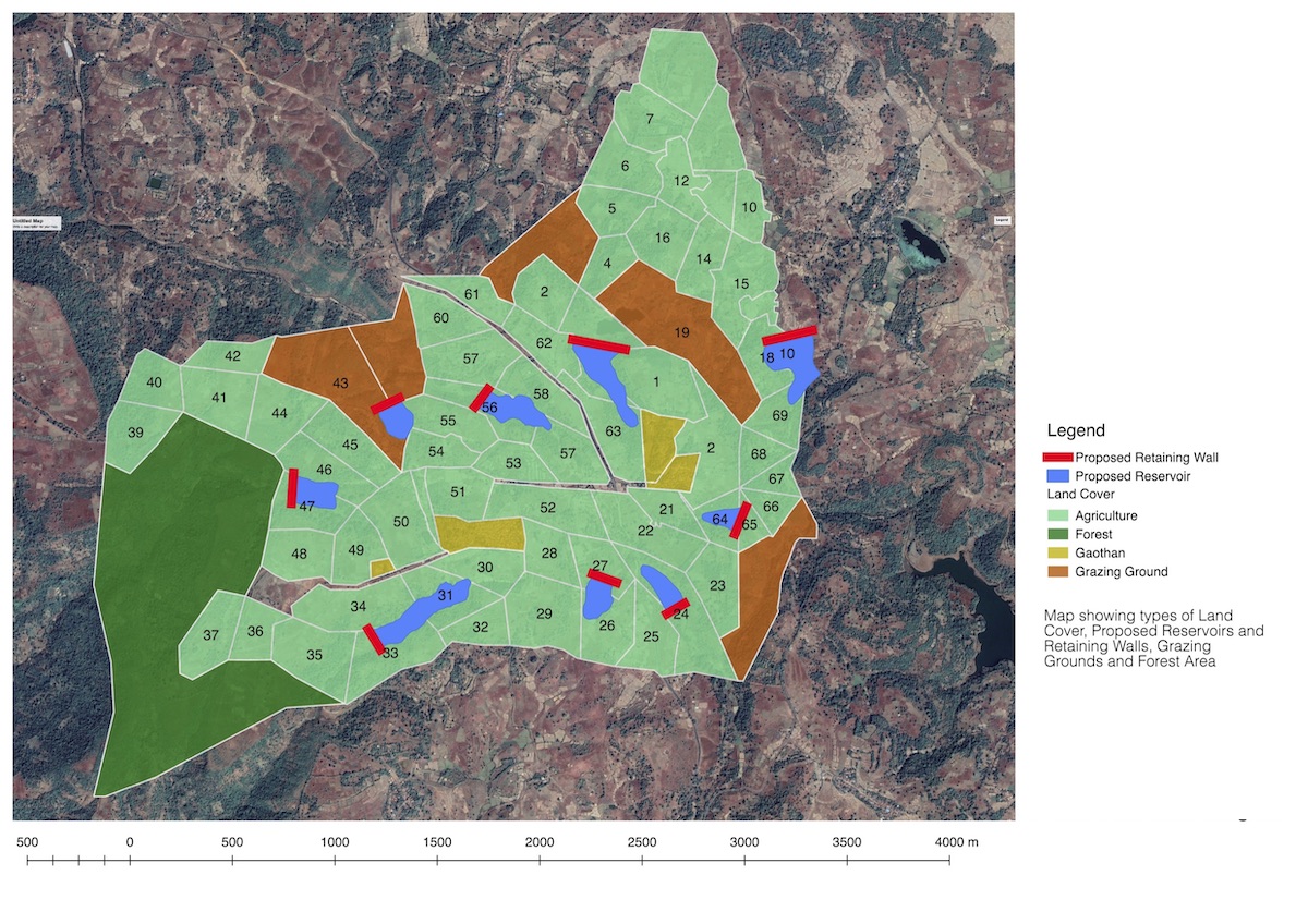
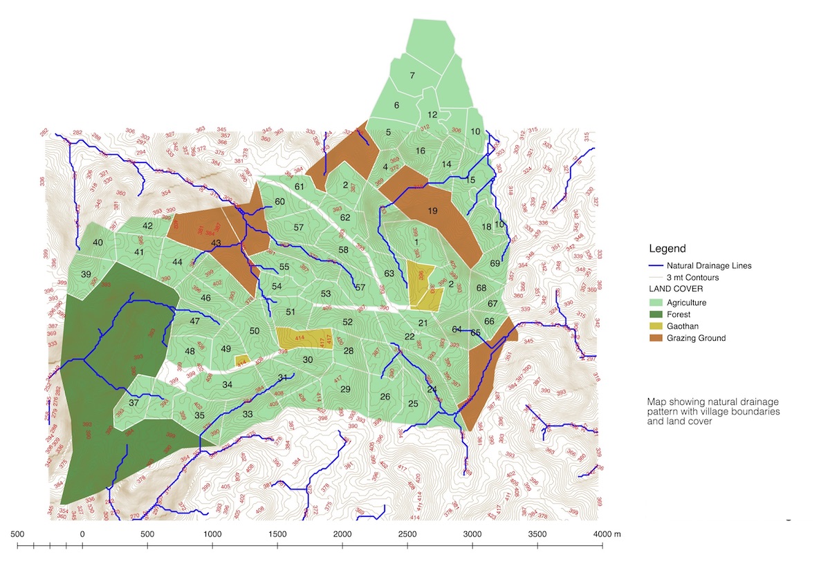
Preparing Maps of Bavkhals of VVSR and Assessment of 3 Bavkhals (ponds)
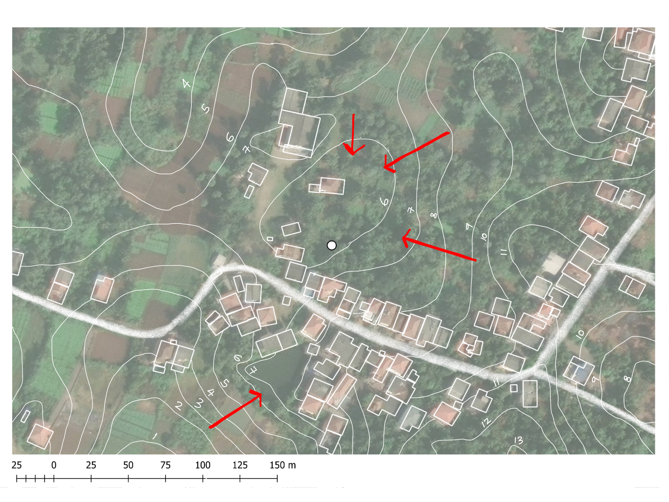
448 Bavkhals in VVSR were mapped and data points were colated to create maps on satellite imagery and village boundaries. Specific interventions were proposed for 3 bavkhals to enable their rejuvenation using NBS.
Vulnerability Assessment of Wetlands in Thane District and NMMC
This is a web interface showing the collection of 100 year old maps of present day Thane District to understand the impact of urbanisation on the wetlands. We documented and inventorised the wetlands in Navi Mumbai Municipal Corporation and assigned a wetland report card for each of the 122 wetlands. Based on a scoring system we arrived at the vulnerability of the wetlands. This further helped us in identifying the 3 wetlands which need a detailed assessment in terms of water tests. Below is a 360 degree of the 3 wetlands studied in detail, including water testing of over 12 parameters and metagenomical analysis. This project was funded by the Aga Khan Agency for Habitat India.
Assessment of Health Amenities in P North Ward, Mumbai
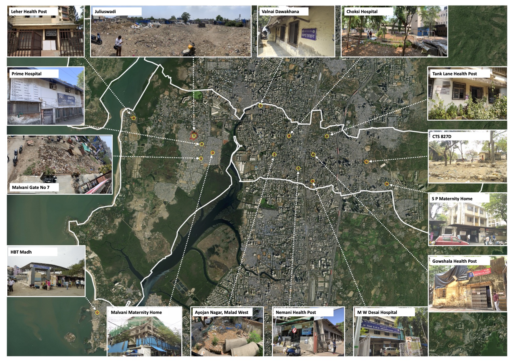
The project was about mapping health amenities located in the P-North ward of Mumbai as per the sanctioned Development Plan of Mumbai 2034. The purpose of this exercise was to ascertain the current situation of these amenities as per the provisions of the DP which can be useful in planning certain strategic actions towards their improvement as per standards. This study also sought to inquire the existing and the maximum potential of the health amenity plot in terms of the permissible FSI as per DCPR 2034.
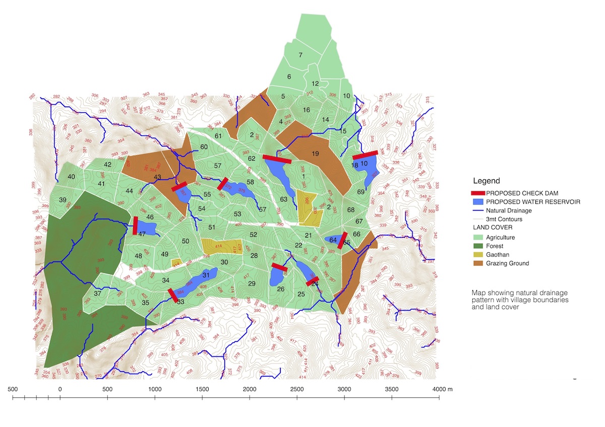
The proposal innovation is to design a passive decentralized wastewater, sewage, and solid-waste system managed by the inhabitants of these villages and integrate them with the surrounding ecosystem. SPARC and community-based organizations would build the communities' capacity and make a plan to treat the wastewater and sewage that would receive a primary anaerobic treatment through reed beds. The villagers could then use the nutrient-rich water in the surrounding lake and the agricultural fields that they own.
This web map shows the waterbodies which we documented, many of which are abutted by vulnerable settlements having no access to sewage treatment. Such waterbodies are polluted thereby polluting the ground water. The waterbody (point) can be clicked on, which will show a popup with thumbnail photo and basic attributes.
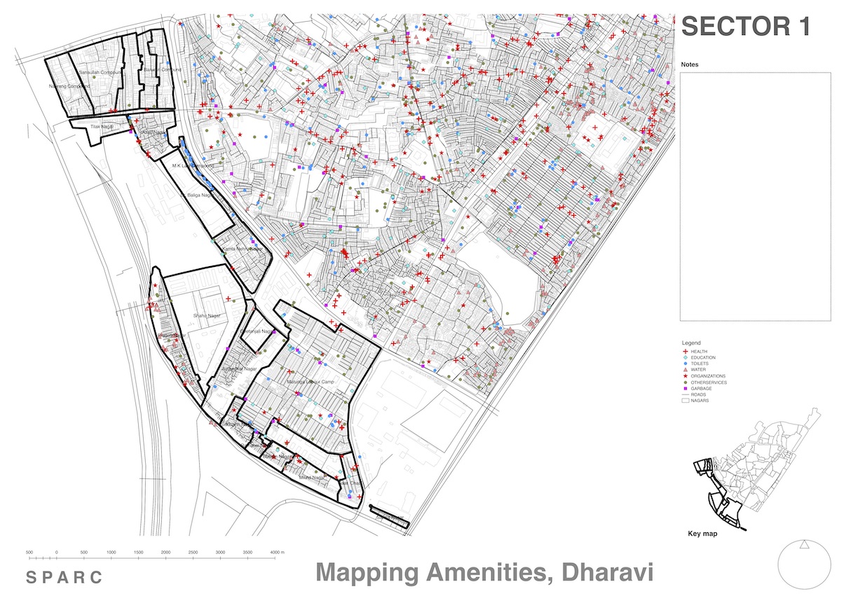
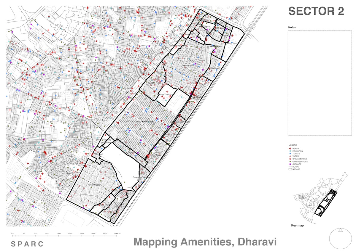
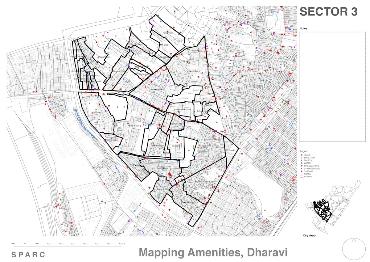
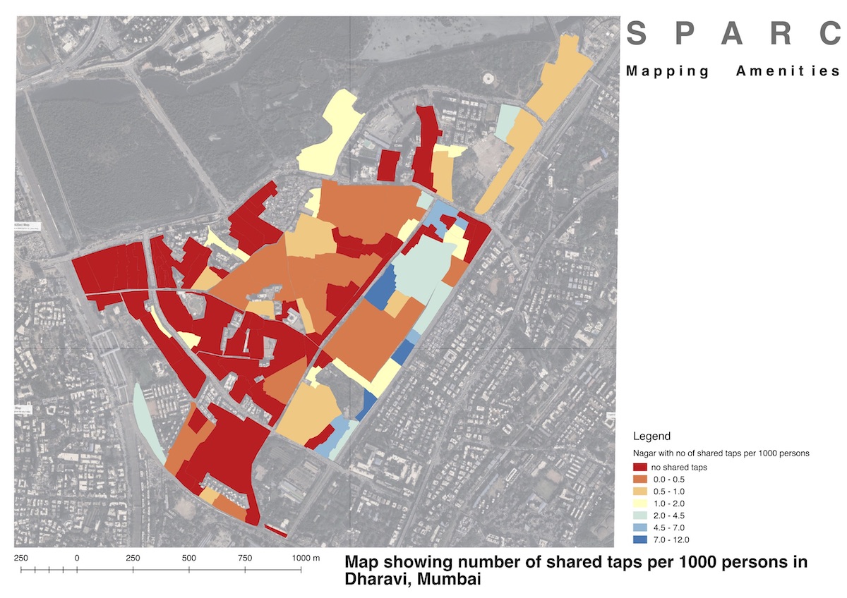
Mapping Amenities, Dharavi, Mumbai
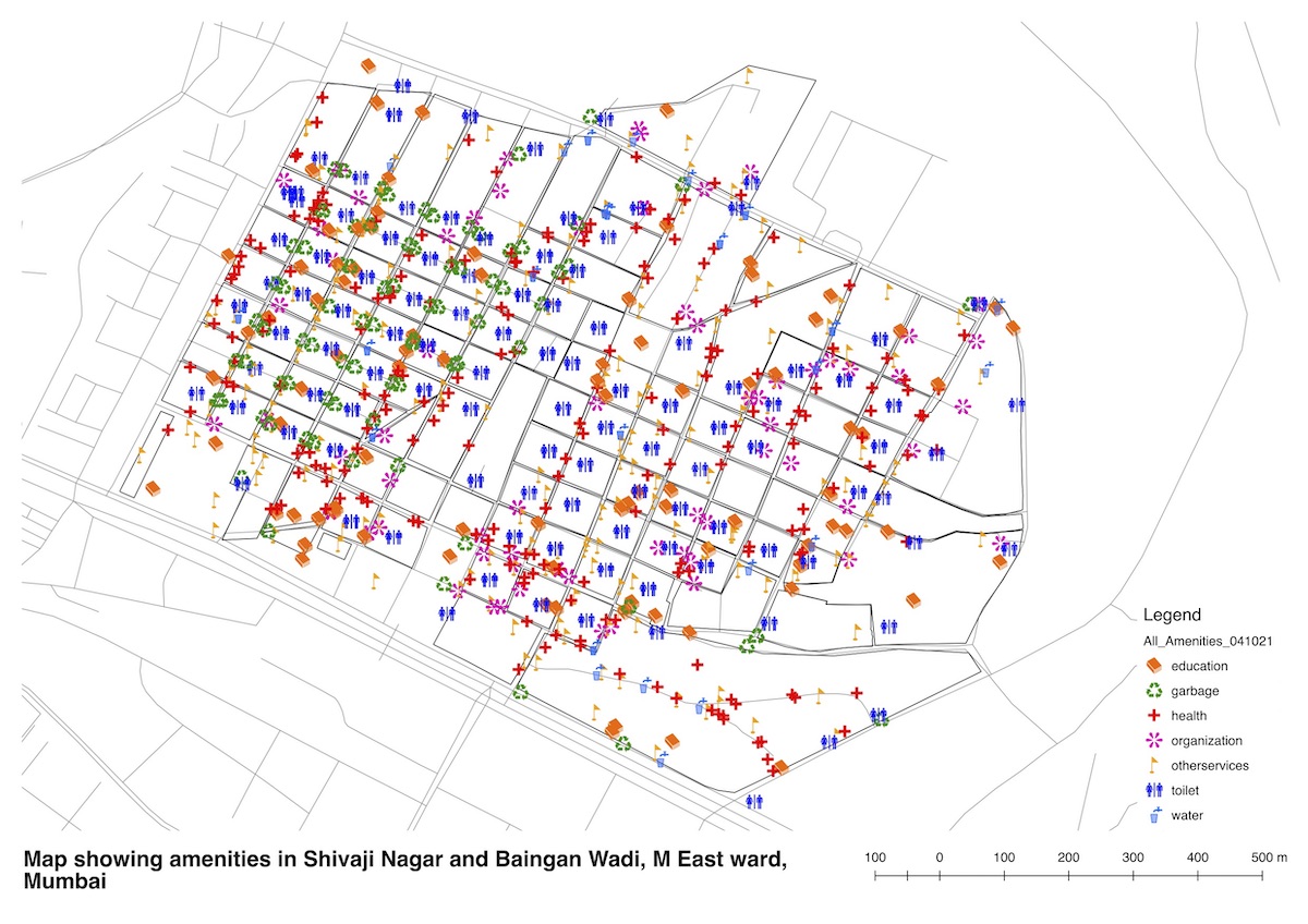
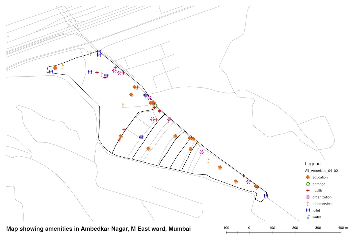
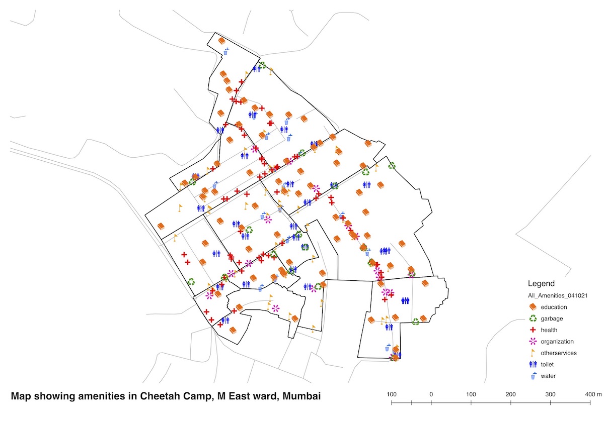
Mapping Amenities, M-East Ward, Mumbai
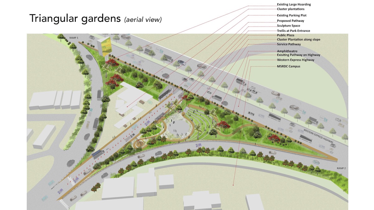
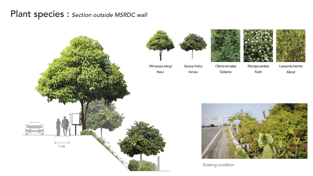
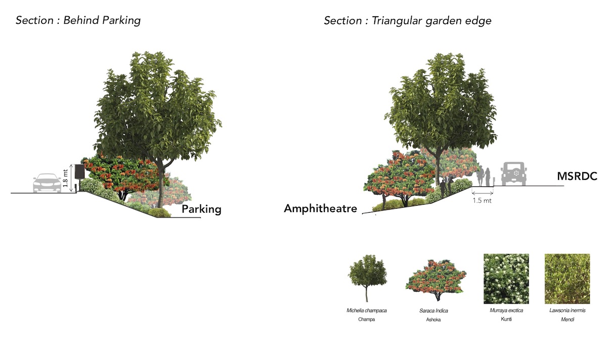
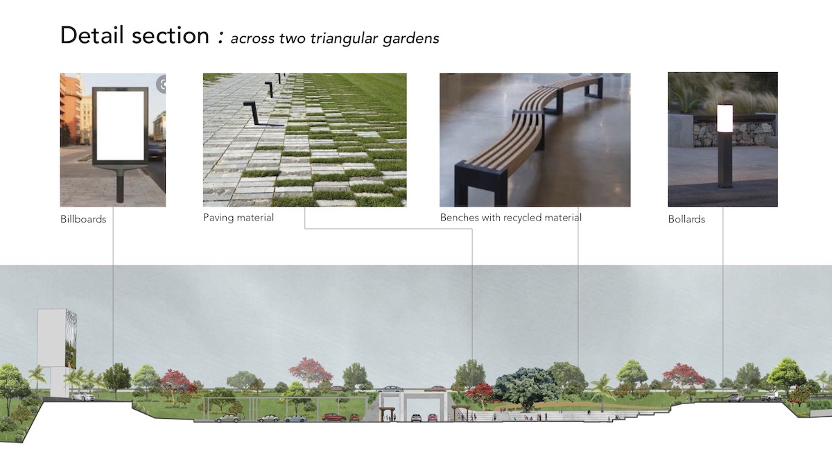
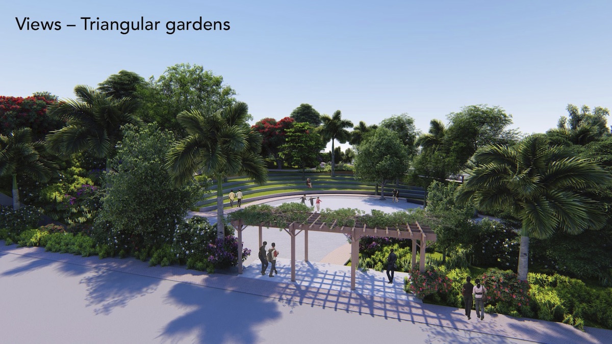
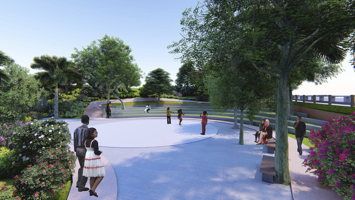
Landscape Design for MSRDC Gardens, Bandra Reclamation, Mumbai
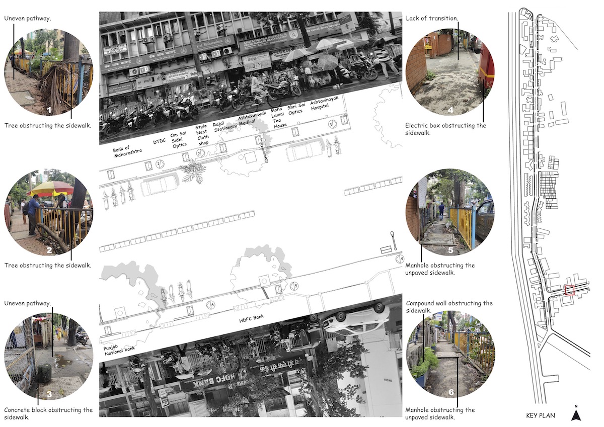
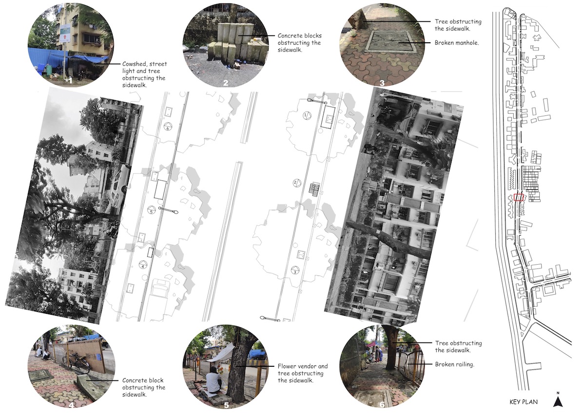
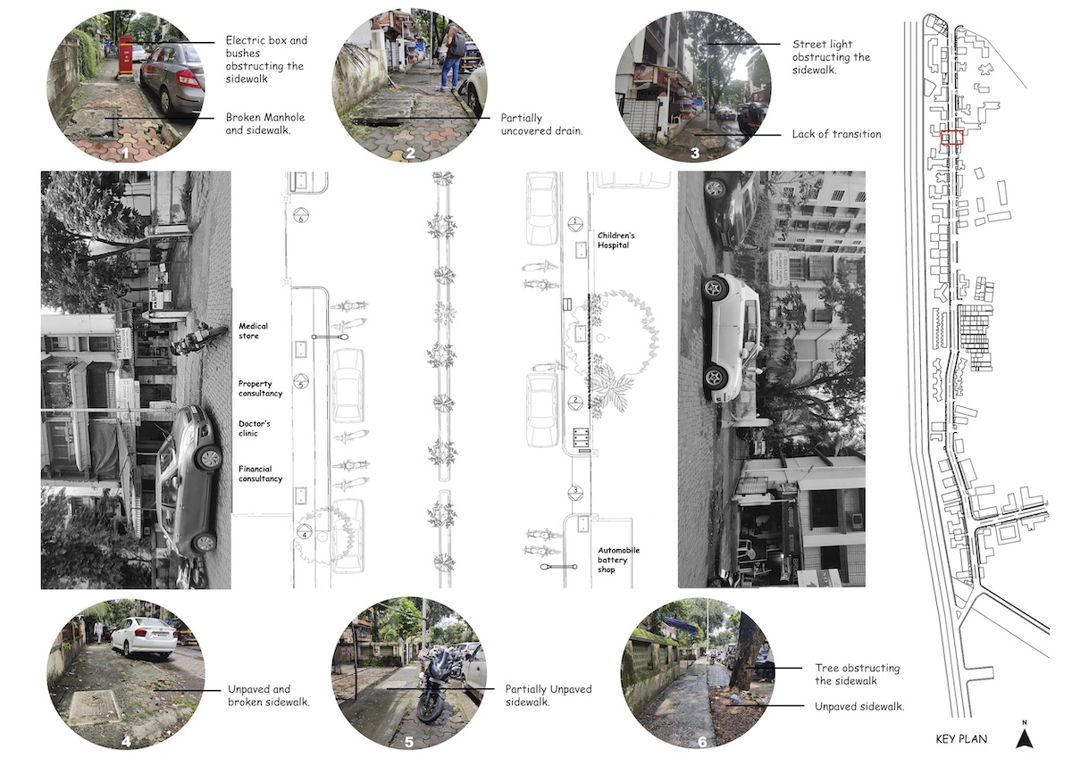
Street Mapping Project, Mumbai
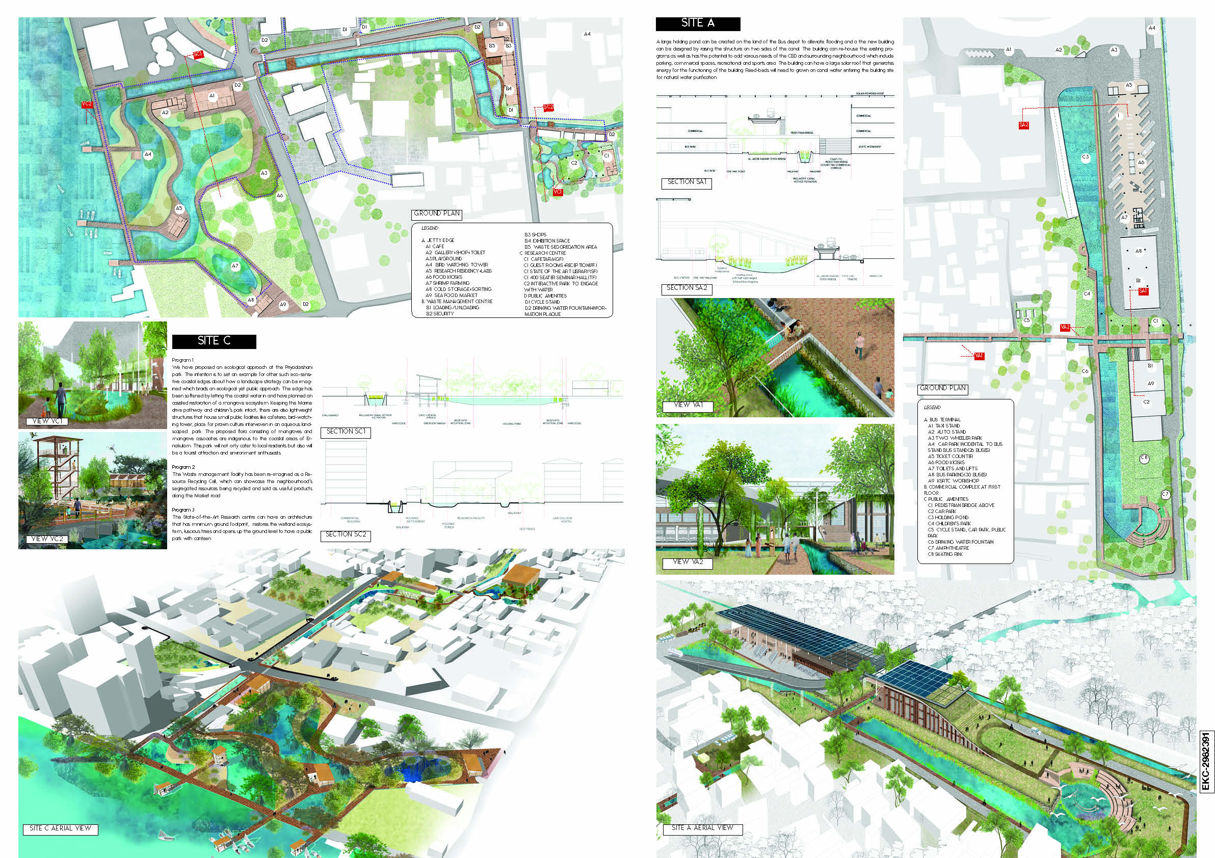
Entekochi Competition, Cochin
Water Management Strategies for Shivajinagar, Jawhar
Office Address
211, Building 20, HDIL Industrial Park, Chandansar, Virar East, 401303

This work is licensed under a Creative Commons Attribution 4.0 International License